Often times I want to know what is going on with the drought conditions in a certain area of Texas and I wanted to share with you all one of the main sites that I use that has a lot of great information. Its called the U.S. Drought Monitor https://www.drought.gov/states/texas
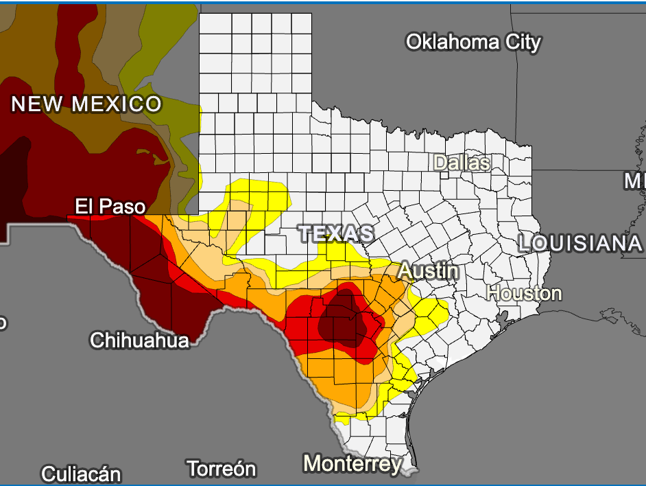
The U.S. Drought Monitor depicts the location and intensity of drought across the country. The map uses 5 classifications: Abnormally Dry (D0), showing areas that may be going into or are coming out of drought, and four levels of drought (D1–D4). The map is jointly produced by the National Oceanic and Atmospheric Administration, U.S. Department of Agriculture, and National Drought Mitigation Center. Authors from these agencies rotate creating the map each week, using both physical indicators and input from local observers.
This map is used by the U.S. Department of Agriculture to trigger some disaster declarations and loan eligibility. Individual states and water supply planning may use additional information to inform their declarations and actions. Learn more.
How has drought impacted this state in the past? Explore historical Drought Monitor maps.
Texas Current Conditions
A number of physical indicators are important for monitoring drought, such as precipitation & temperature, water supply (e.g., streamflow, reservoirs), and soil moisture. Learn more about monitoring drought.
Take a look I think you will find the information here helpful!